


Fortified city above Skadar lake, Rozafa fortress
10 comments
Ever since I studied epic folk songs from my native lenguage as a young student, I have been intrigued by the theme of the song

At that time, I knew that Shkodër is a city in Albania and Bojana is a river that flows by this city, but I did not know why the song sang about the construction of the city over many years and the building of a young woman into the foundations of the city.
It was then explained to us that the lesson of the song is about sacrifice, which must be made in order for something magnificent to be done (the sacrifice of a young woman, who was built into the foundations of the fortress, even though she had a small baby), and about betrayal (two older brothers betrayed the younger one) that we can sometimes experience even from the closest family members.
But the idea of building that city was still unimaginable to me. And that Shkodër on Bojana was on my list of places to visit for many years.

The city of Shkodër actually existed a long time ago.
The town next to the big Skadar lake, after which it takes its name, was mentioned as early as the 4th century. Through several centuries of the Serbian state in these areas, the city was eventually sung in the epic song of the pre-Kosovo cycle, which actually marked the end of the medieval state of Serbia in these areas.
After Serbs, the city is short
ruled by the Venetian Republic, and after that, by the Ottomans, for almost 5 centuries.
After the Balkan wars and the collapse of the Ottoman Empire in the Balkans, Shkodër was occupied by Montenegro, and by the peace agreement at the beginning of World War I, Shkodër was handed over to Albania, which it is still part of today.
Reading about the history of the city and the fortress located on the hill above today's Shkodër, which can be seen from all parts of the city, legends about the fortress, about love, suffering and betrayal were intertwined.
 |  |
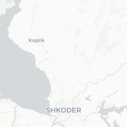
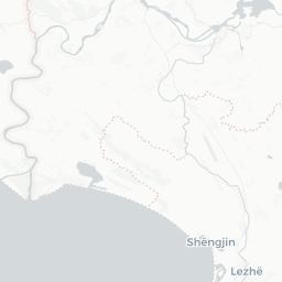
The hill above Shkodër, with a fortified town (today the Rozafa fortress), is located between the rivers Bojana, Drim and Kin, which flow into one, the river Bojana, which flows to the Adriatic Sea.
The entrance to the fortress, which is over 100m above sea level, can be reached by car, and there is also a small (free) parking lot.
 |  |  |


From the parking lot and the ticket office where we bought the tickets, you have to walk further.

The view already when approaching the entrance to the fortress is fantastic, but let's not talk about the view yet, there is time, when we climb a little more...


Fortified walls and a large gate represent the entrance to the city.


The ramparts are still in a preserved state, but at every step there are signs informing that climbing the walls is prohibited.

Considering what the floor looks like on which to walk - sharp, raw stones, I believe that the walls are also dangerous to walk on.

That's why I didn't climb where there are warnings.
This fortress has three levels - three courtyards, which you pass as you climb towards the citadel (the highest point of the fortress).


When passing through the first courtyard, I started for the ramparts, but my attention was drawn to the room under the rampart.

Such a low, narrow and dark room looked to me like a place where a young woman could be walled up in a folk song.


But even so dark, it has an opening through which there is an interesting and beautiful view of the city.
When I got out into the sun, I climbed the rampart and that was my first view of Skadar, the Bojana River and the nearby Skadar Lake (the Bojana River doesn't actually have a source, it is formed in full flow from the Skadar Lake).

After a few panoramic photos, I headed to the second courtyard (the largest in the fortress).


In that area, there is a large area without buildings, so it can be concluded that there were houses of people who lived in this town on the hill, and that there were many people, which is confirmed by the number of wells, of which there are quite a few. In fact, these are not classic wells from which water can be taken and which are replenished from underground water, but tanks in which rainwater was collected, which was used for consumption.
| - | - |
| - | - |


In the second courtyard there is also a church building, which changed religions over the centuries, was a church, a cathedral and a mosque.
| - | - |


| - | - |


At the end of the climb to the top of the fortress, you pass through another gate and exit to the third courtyard.

That, the smallest area of the Citadel, is the highest point of the fortification, so it is understandable that the most beautiful view can be seen from its ramparts.


| - | - |
| - | - |
| In the part of the Citadel there is a museum building, the former command of the city, but at the time of my visit, the museum was not working. Instead of sitting in a cafe on the fortress, I chose to look around from the ramparts, enjoying the pictures I saw with my eyes. |


As someone with an investigative spirit, I also found a few interesting details.


This white stone well is different from all the others, it was probably set aside only for the inhabitants of the citadel, and the opening in the ground with a steep, narrow, stone, spiral staircase caught my special attention.
Where do they go?
Somehow I descended to the bottom and at the other end of the narrow tunnel, I saw a passage.


It was clear, these were the stairs that led from the citadel to the walls of the ramparts, probably used for evacuation in case of conquering the highest courtyard of the fortress, the Citadel.
I took a photo of my friends climbing the ramparts, as well as these two visitors, who came dangerously close to the edge.


The walls on which they are now standing are the same ones that I took pictures of when approaching the fortress, very high and on a steep slope, so the wind that was blowing made the situation even more serious, so those warnings also had an important message.
Don't climb the ramparts, and I might add, don't get too close to the edge.
I stayed a little longer in the Citadel, looking for positions from which the view is beautiful, and thus I found a building with a stone roof, as well as holes that served either to carry water to the reservoir or to illuminate the rooms underground.


Although the poem I learned 35 years ago described the tragic fate of a young woman who was built into the foundations of this fortified city, no sounds were heard that could be interpreted as her crying...
But it is not difficult to imagine, the cloudy sky, darkness and strong wind howling through this city, would send chills to the bones of anyone who happened to be here, especially if that howling wind was connected to the legend of this fortress.
Comments