Recommended Posts

Rocks Full of Scars: From Russia with Love
7 comments

Germany - once the proud nation of high-tech industry and global-exporting factories - now finds itself fringed by tales of what might have been: abandoned innovation parks, ruined industrial halls, and ambitious visions lost to decay. But some places are different - older, deeper laid in time.

So a magician place in mountains Harz are: the oldest marks in the sandstone of the Klusberge were carved thousands of thousands of years ago, the most recent ones date back to hikers during the Corona period.

For thousands of years, people have lived, prayed, and settled on the Klusberge near Halberstadt. During the GDR era, the bizarre mountain range was a restricted area. Even today, astonished hikers still find deep traces of history in the soft sandstone.

Greetings from Russia
“Voronezh,” someone scratched into the rock. “Alexander,” is written a little further on in Cyrillic letters, patiently rubbed into the surface of the yellow sandstone. Greetings from Russia with Love, left in the 45 years when die soviet army were the one and only owner of the area.
A gallery of rock carvings stretches along the walls and into every cave. Traces remain everywhere of Sascha, Igor, and Pyotr, who must have sat here many years ago – thousands of kilometers from home, strangers in a foreign land, and probably with little eye for the beauty of the landscape lying beneath the Klusberge near Halberstadt.

As soldiers of the
, the young men were occupiers, protectors, and strangers all at once. They were not allowed to leave the military grounds. No one else was allowed to enter the forbidden land around the airbase barracks on the outskirts of town.
Not far away, a memorial plaque still recalls the role Halberstadt once played in the development of aviation. The moss-covered and weathered monument commemorates six German pilots who died here in the summer of 1917 in the crash of a giant aircraft of type R14.
Caves under caves
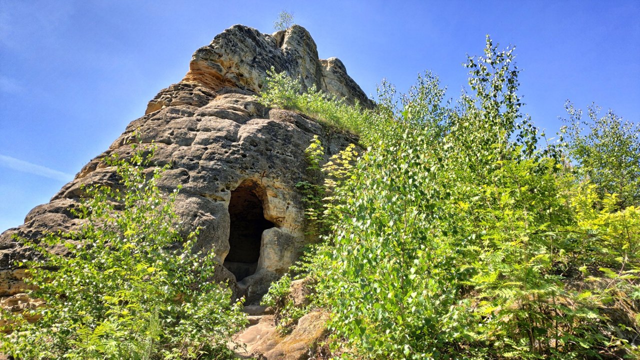
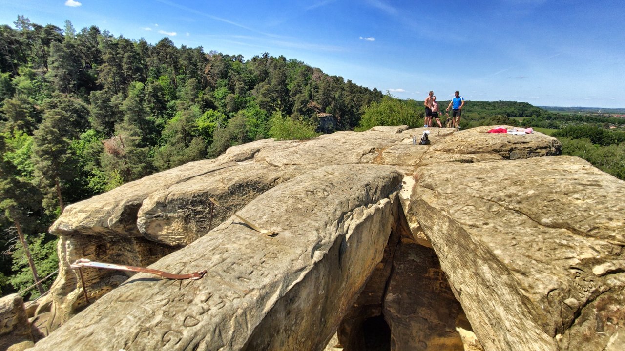
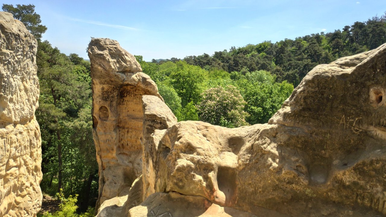
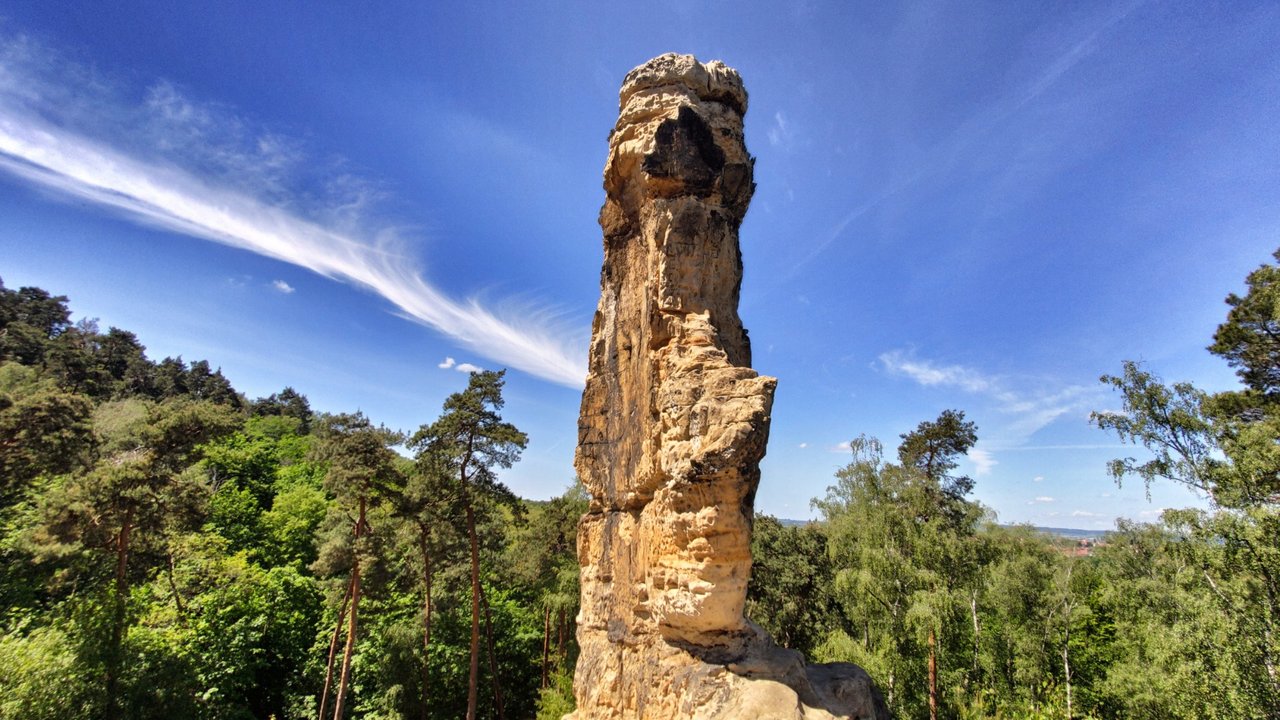
At the foot of the sandstone needles, shaped by wind and weather, much history has accumulated. Already thousands of years ago, there was an observatory here from where people are said to have observed the course of the stars.

Archaeological finds reach back to the Neolithic, in the same place where hikers now admire bizarre rock formations like the Five-Finger Rock and the Devil’s Chair, and where couples carve their names and hearts – next to the crosses and marks left by monks long before.

The first documented mention of caves in the then-bare rocks dates from 1070. The Klusberge, 193 meters high and named after a hermit or “Klausner,” were at that time owned by a monastery. Later, a brotherhood of shepherds moved in, who enlarged the sandstone caves to serve as dwellings and prayer rooms.

In 1070, the caves of the Klusberge were mentioned in official documents for the first time. Their name goes back to one of the hermits. Today, the Klusberge are a popular destination – with caves that offer no view, but plenty of graffiti.
Secret Projects
Not much remains from the time when the area was a restricted zone and the subject of legends: people claimed that nuclear weapons were hidden here, along with bunkers so vast that thousands of tanks could be stored. The Third Reich eventually discovered that the area between the Klus-, Spiegel-, and Thekenberge was a perfect place for underground arms factories.

Starting from cellars where mushrooms were once grown, the plan was to move the Halberstadt wing production plant entirely underground. The “Makrele I” and “Makrele II” projects, built by the Halle branch of Grün & Bilfinger AG using prisoners of war and forced laborers, were to provide space for bomb-proof production facilities.

In the neighboring Thekenberge, concentration camp prisoners were forced to dig further caverns. The “Malachite” project was intended to house a jet engine factory with 6,000 workers. Even during the war, the entire region became a no-go area – and it remained so afterward.
The 49th Guards Tank Regiment of the GSSD moved into the mountains. The unit had originally been formed in Voronezh – which explains the inscriptions in the sandstone.

The vast halls of "Malachite"
The reality was more mundane: the vast halls of the “Malachite” project, built at the cost of concentration camp prisoners’ lives and conveniently connected to a rail line, were used by the East German NVA as “Complex Warehouse 12” for storing supplies in case of war.

With the end of the GDR, the old hiking trails were reopened. The Russian troops withdrew, and the NVA handed the site over to the Bundeswehr. Yet mystery lingered: after monetary union, the Bundesbank hid billions of East German marks in the kilometer-long caverns of “Malachite” – the very bills that East German citizens had once exchanged.


Comments