

22 HIVE Boreholes on a Custom Google Map
8 comments
Last night I came across an X post by @mcsamm
and followed the link through to his blog article on PeakD https://peakd.com/hive-176874/@mcsamm/blockchain-for-humanity. On that page you’ll find a clear summary of the 22 fresh water boreholes the HIVE community has brought to life in Ghana, each one linked to its own story and images. Reading through it, I was struck by two things. First, the scale of the effort is truly inspiring. Second, although the photographs give a vivid sense of life at each site, I realized I had no real sense of where these places actually are.I’ve never been to Ghana and can barely point out half the districts on a blank map. Sure, the write-ups include the names of villages and regions but, without a visual reference, everything feels a little abstract. The pictures show smiling children drawing water, proud community members standing beside new wells, and the dusty roads that lead to each site. They give you a feeling for the work but leave you wondering how far one village is from another, or whether a borehole sits high in the hills or down by a river.
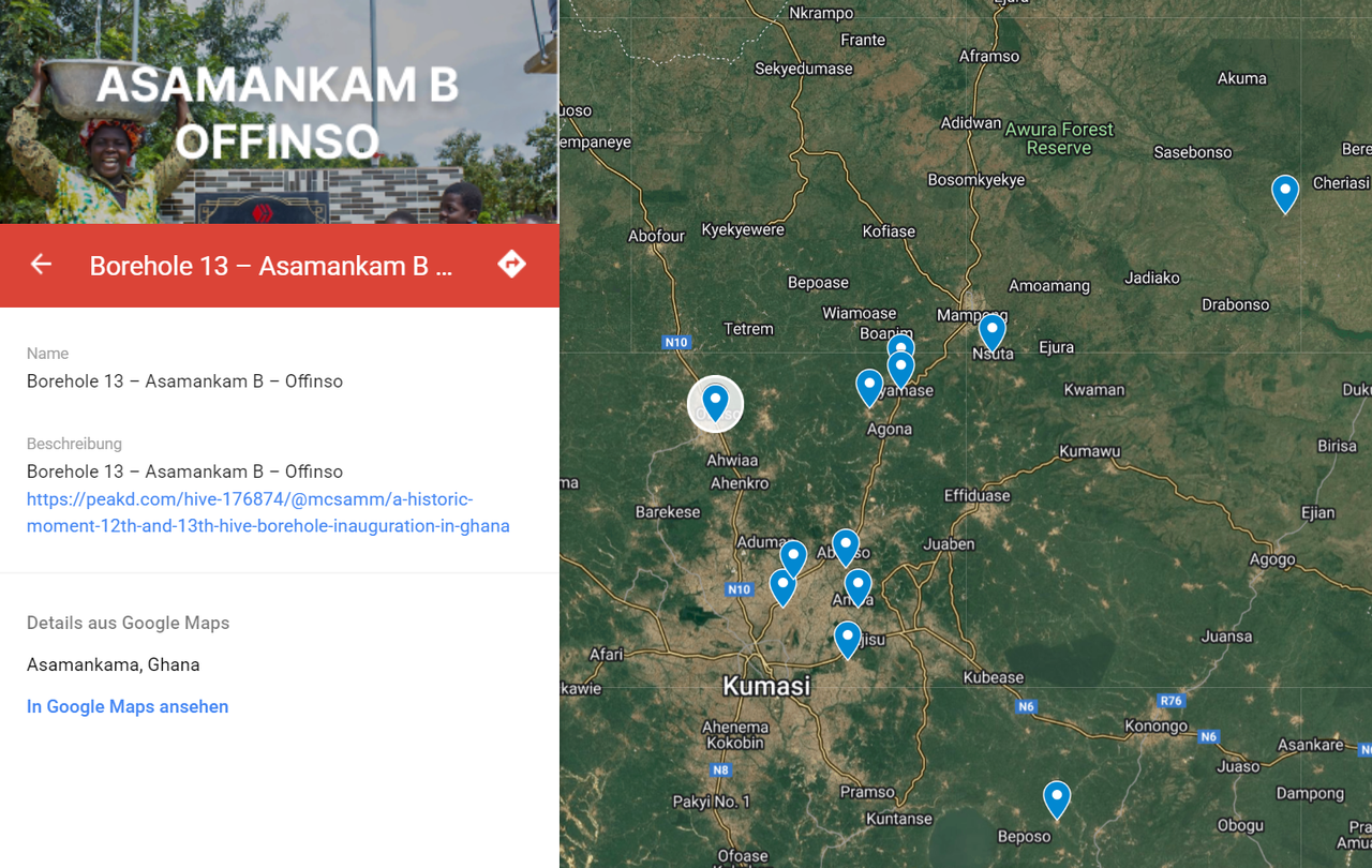
To bridge that gap I decided to plot every single one of the 22 locations on a Google Custom Map. It took me less than an hour to gather the coordinates from the articles, drop the markers on the map, and label each site with its name and a link back to McSamm’s write-up. The result is a single interactive view that lets you zoom in and out, click on any borehole for more details, and get a real sense of the geography behind the project.
Here’s the link to the map if you’d like to explore for yourself: https://www.google.com/maps/d/viewer?mid=1Sub3J39ZI_quKmoO63wP551xnRCX4RQ&ll=8.070895280694074%2C-0.7389044914062515&z=8
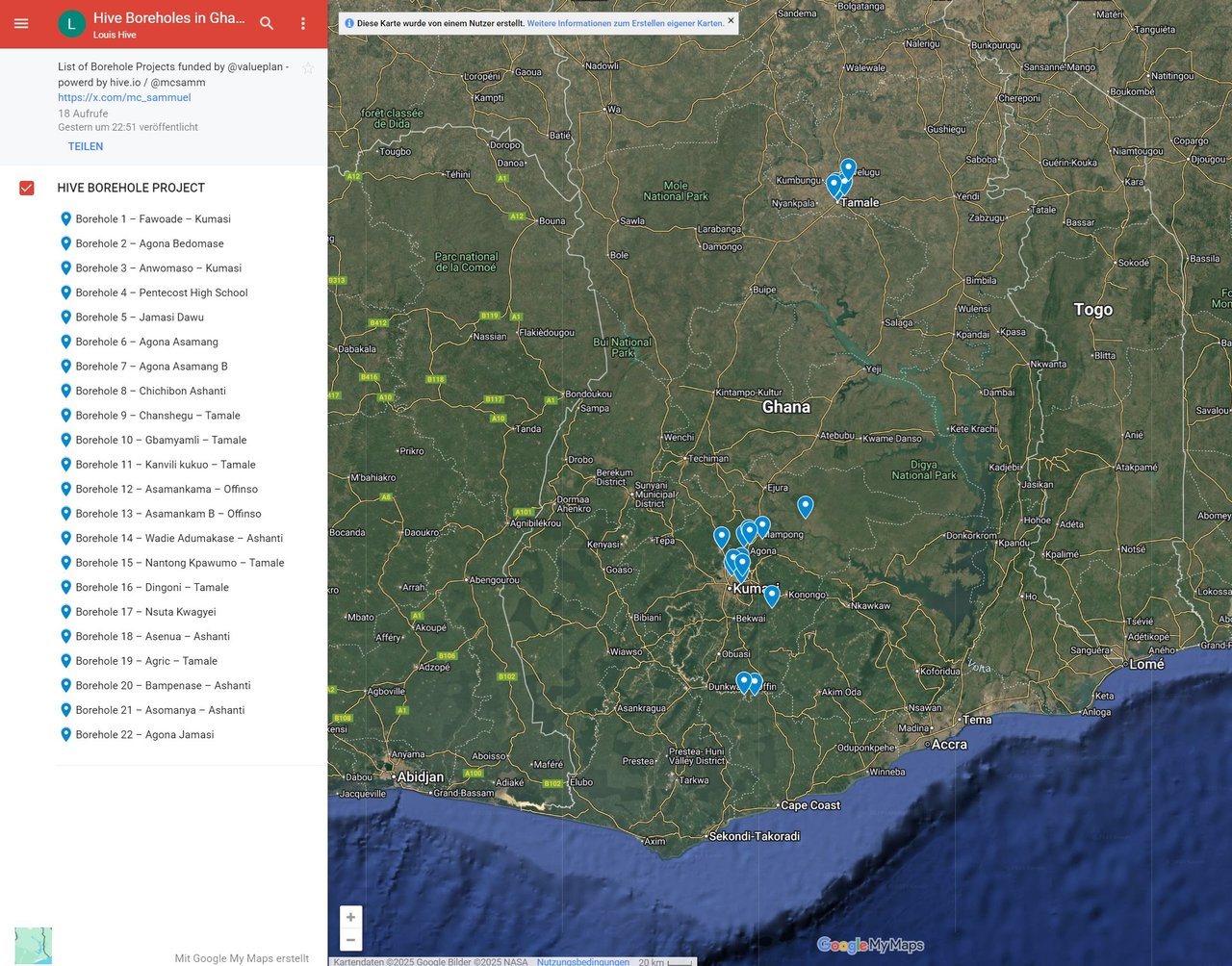
What I love about this is how it transforms a list of efforts into a living snapshot of impact. You can see two wells just a few kilometres apart in one district and another that sits thirty kilometres away in a completely different region. You can trace a path from the southern coastal plain up to the northern savannah. For anyone who cares about how community-led development works on the ground this adds a whole new layer of understanding.
I hope this map proves useful to anyone following the Hive Boreholes project. Maybe you’re planning a field visit and want to chart a travel route, or maybe you’re doing research and need a quick visual reference for where each borehole sits. Even if you’re just curious, it’s a small but meaningful way to appreciate the scale and spread of what McSamm and the Hive community have achieved.
Putting it together cost me almost no time but I think it makes a big difference. It’s one thing to read about 22 fresh water wells; it’s another to see them pinned on a map across Ghana. If this helps even a handful of people grasp the scope of the project a little more clearly then it was well worth the few clicks it took to build. Feel free to share it, explore it, and dive back into each story through the links I’ve embedded. It’s been a small personal project but one that deepens my appreciation for the power of community-driven change.
Comments